INTRODUCING

Manage a multi-drone BVLOS delivery network, remotely from a centralised location, with our software. RigiCloud integrates several data sets and powerful tools, specifically designed for aerial logistics.
Our software powers the Eiger, leading the way to innovative, smart navigation solutions, allowing your business to reduce delivery times and cut ground transportation costs.
CREATE
YOUR
NETWORK

1

2
Send SORA to regulators.

3
Operate BVLOS routes remotely.

4

5
WHY RIGICLOUD?
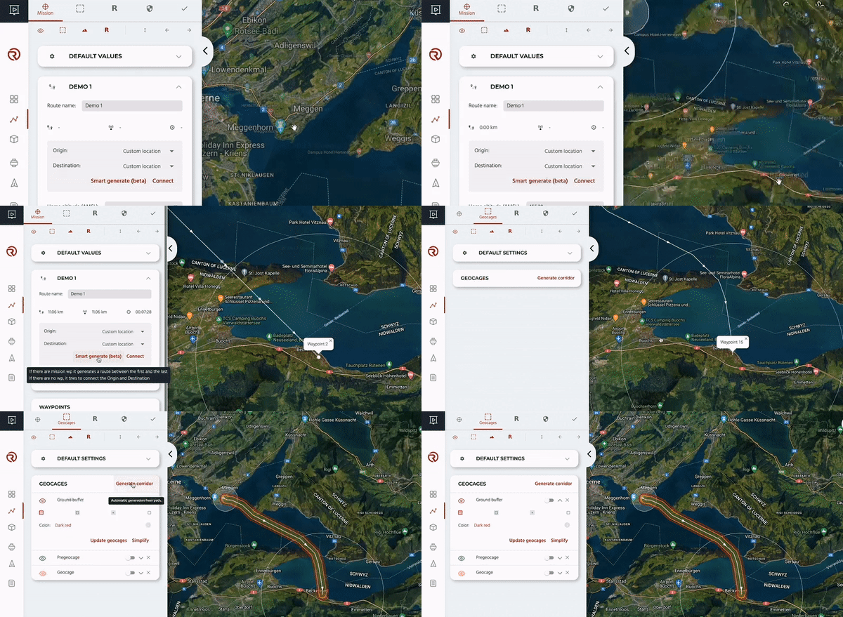
Automatic Route Generation + Smart Geocage Corridor
Generate your route by selecting take-off and landing points on the Airbridge Planner. RigiCloud automatically draws an optimised route considering geographical characteristics, population density and total distance.
Quickly generate the necessary geocages, ensuring safety along your drone delivery route. RigiCloud will automatically define safety boundaries for drones to complete the route, and trigger predetermined actions if boundaries are breached.

WORLDWIDE POPULATION DENSITY MAP
As you plan your route, easily refer to our integrated global population density map as an additional layer that can be toggled on or off. RigiCloud’s features are designed to support route planning following the Specific Operations Risk Assessment (SORA) methodology.
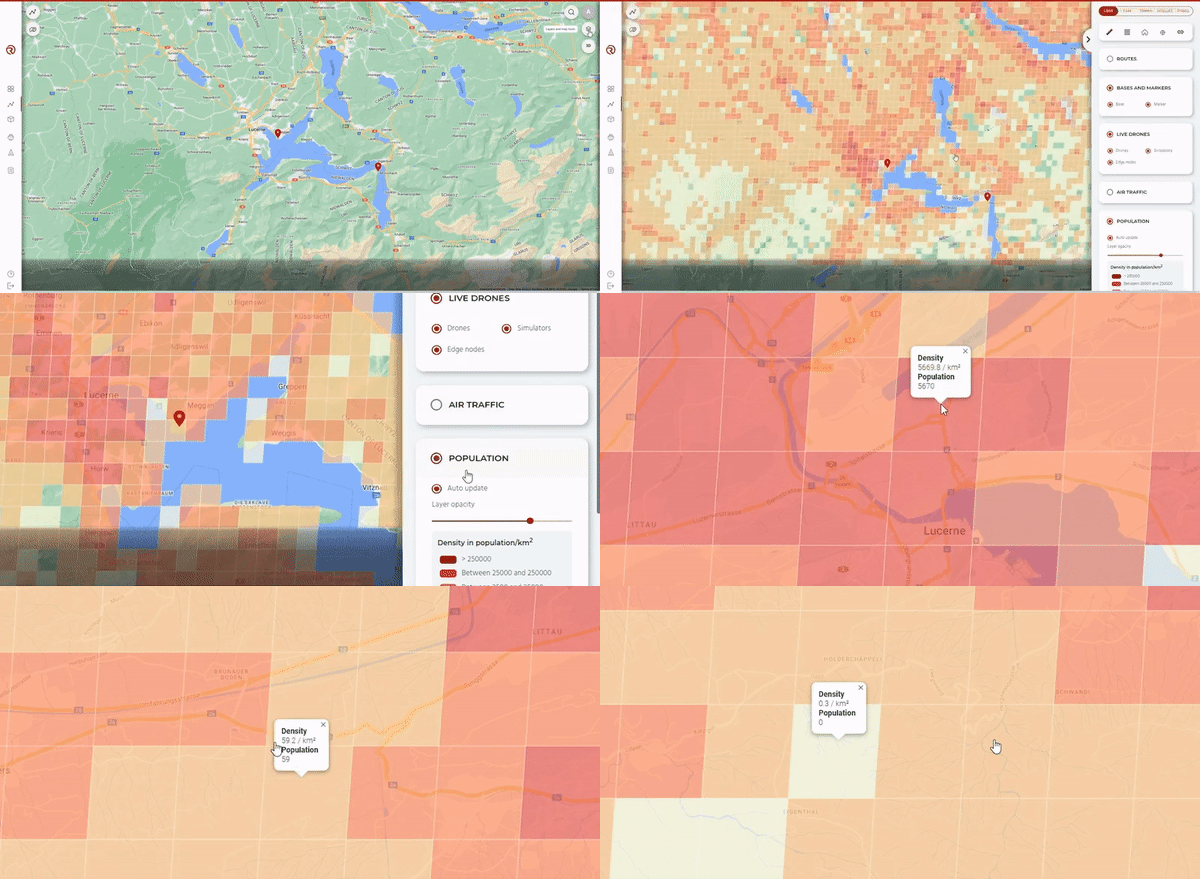


Worldwide Population Density Map
As you plan your route, easily refer to our integrated global population density map as an additional layer that can be toggled on or off. RigiCloud’s features are designed to support route planning following the Specific Operations Risk Assessment (SORA) methodology.


Multi-Drone Flight Simulator
An invaluable tool for both operators and end customers, RigiCloud offers a multi-drone flight simulator for all planned BVLOS operations. Recreate realistic environments, accurate flight dynamics, weather conditions, and terrain types. Test drone performance during potential emergency procedures, and take advantage of this essential resource for operator training.
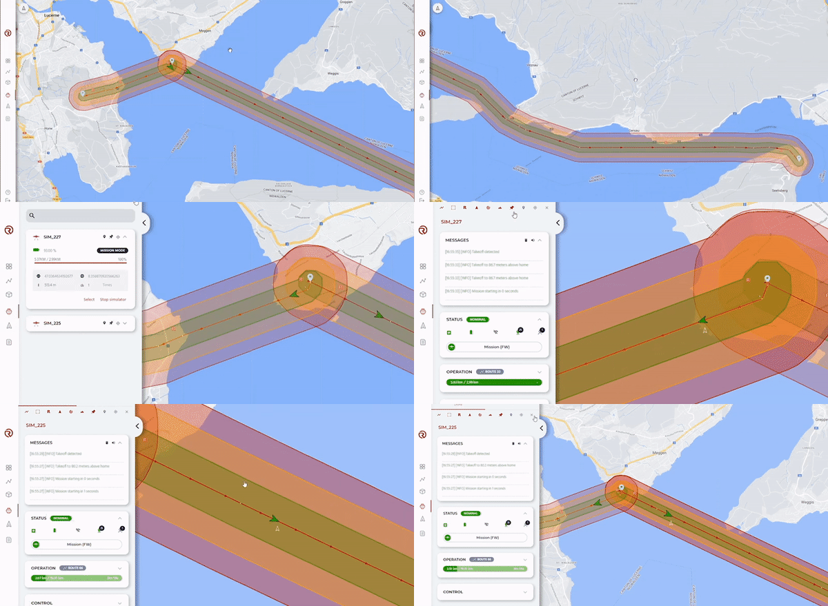

DETECT AND AVOID AIR TRAFFIC
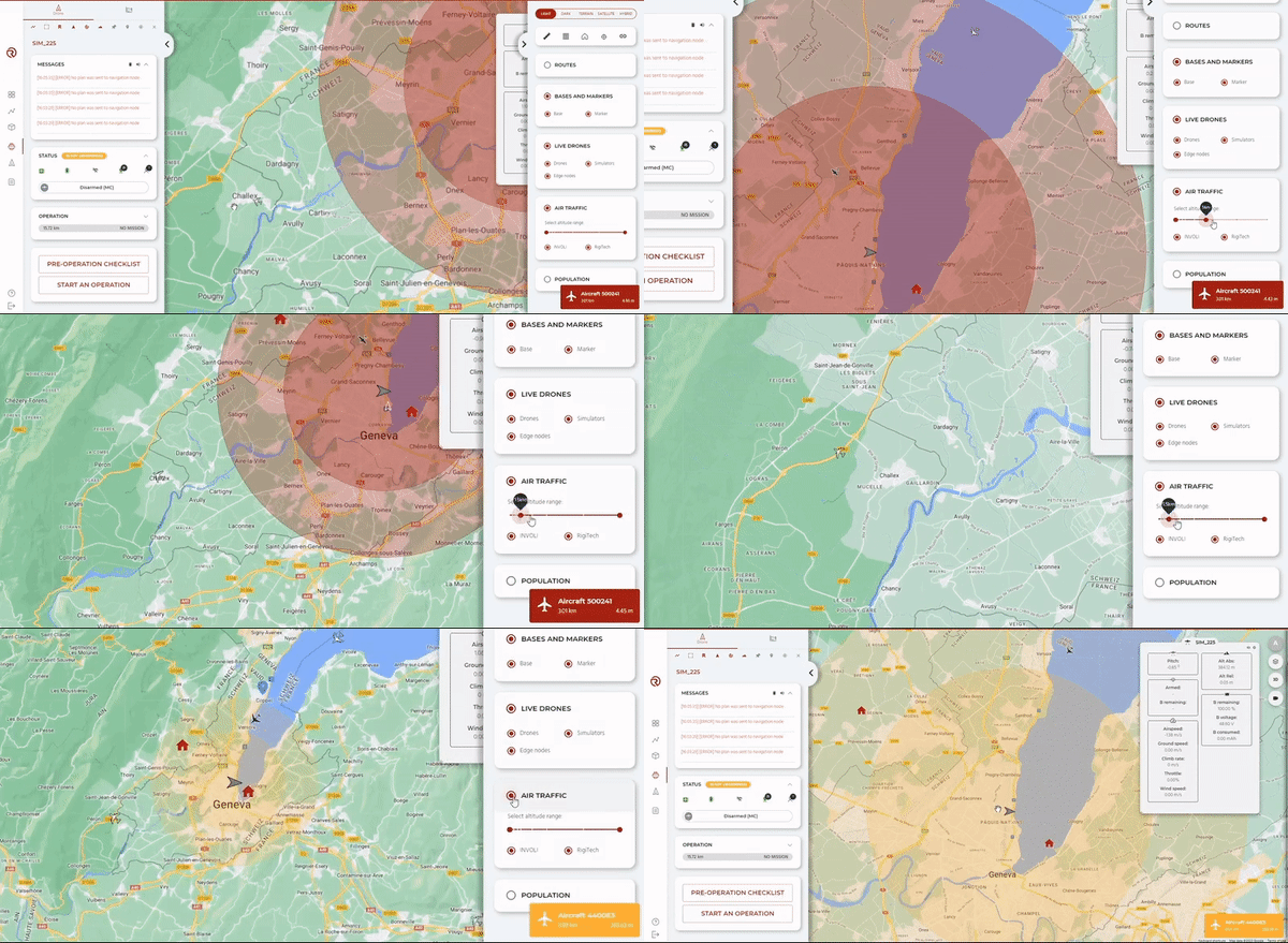
Assess air risks in real-time during your operations using integrated data. RigiCloud provides airspace data, live air traffic information, and automated alerts for conflict zones, allowing you stay aware of potential hazards. Define detection volume cylinders around each drone’s position, and receive both sound and visual alerts to ensure safe operations.


Detect and Avoid SYSTEMS
Assess air risks in real-time during your operations using integrated data. RigiCloud provides airspace data, live air traffic information, and automated alerts for conflict zones, allowing you stay aware of potential hazards. Define detection volume cylinders around each drone’s position, and receive both sound and visual alerts to ensure safe operations.


USER MANAGEMENT AND REPORTING
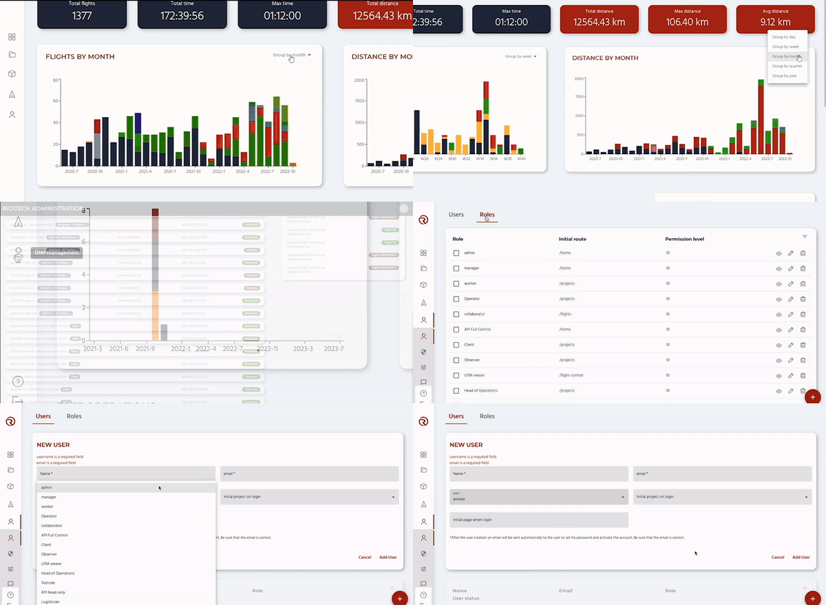
Enjoy complete control over your organisation within RigiCloud. Assign custom roles and permissions to each member of your team within RigiCloud, ensuring safety while promoting cross-functional collaboration. Generate and export reports directly from RigiCloud’s Dashboard, as well as from each user’s Profile and Operation History.
BEYOND THE BASICS
ground staff delivery requests
Cloud-based software
for remote access
for custom front-end design
Discover the technology behind successful worldwide BVLOS operations and the Eiger’s exceptional performance.

